To start out this story, it’s probably worth mentioning that hiking the Rae Lakes Loop has been my wife’s dream ever since childhood.
Kings Canyon is the special place that her family visited over and again, and the words of the rangers telling of this epic backpacking trip for many years made this something of a dream trip. Trust me…she’s mentioned it more than just once or twice…
Getting equipped was no easy task. Gear for the four of us, thousands of dollars spent on packs, tents, sleeping bags, water filters, jet-boil stoves, bear vaults, boots, socks…over the span of a couple of years we accumulated a closet full of outdoor equipment. REI made a killing off us. But in perspective, it was still less than a couple of year’s worth of bicycle racing.

The next challenge: getting a backcountry permit. This is one of the most popular backcountry trips in the Sierra Nevada. The lottery for trail permits opens on March 1 of every year; permit applications may be snail-mailed or faxed, but either way, unless the postmark date is March 1, you don’t stand much of chance if you are requesting peak season in July or August. Pick any other time, and you take a chance on the weather or someone’s school schedule. A similar situation exists for many of the popular hikes requiring permits; Mt. Whitney, for example. The year before, in 2015, we applied for and received a permit for a seven-day Rae Lakes trip with dates in September, only to have the permit canceled when the Rough Fire tore through, decimating much of the lower canyon, Cedar Grove and the wilderness area up the Middle Fork of the Kings River. We were pretty disappointed, not just in the cancelation, but in the knowledge that over 151,000 acres of national park, forest and wildness had been lost. The Rae Lakes area was unscathed, but the family’s heritage of visiting this spectacular place will never be the same in our lifetimes.
So again on March 1, 2016, I faxed in a permit request. And heard nothing back. In May, with no response to my application, either yes or no, I panicked. After our disappointment the previous year, we couldn’t bear to put off the trip for another year again. I called the
SEKI Backcountry office and left a voicemail. To my surprise, I received a permit by email the very next day for the exactly the dates we had requested! Barring another calamity, we were on. But wait…there’s more. We had calculated Sam’s summer school schedule incorrectly. He was taking a course than ran half the summer term, and was due to end July 22. Our permit had us entering the wilderness on Sunday, July 24. The summer school term did end on July 22, but the final exam was Tuesday, July 26. I made another call to the backcountry office. The following week was not available, except if we could do the trail loop backwards…meaning climbing up the steep Bubb’s Creek trail, and descending the more moderate Woods Creek trail. This counter-clockwise direction isn’t as popular, since the ascent to the nearly 12,000-ft Glen Pass is covered by a much shorter distance. We had no choice. Putting off the trip for another year wasn’t an option. We had put too much time into preparation, getting into “shape”, and who knows where the boys would be a year away?
Saturday, July 30
Captain Richard had originally planned to join us on this hike. Aside from being my best friend from school, he’s taken on “a life of adventure”, traveling all over the world, and most recently making the journey to Machu Picchu in the Andes. We had him listed on our permit, and since he lives near Visalia, his home was the logical staging area for the trip. However, Captain Richard’s trip to Peru apparently contained too many “bathroom moments”, and his sense of personal hygiene had been violated by lack of sanitary facilities into which one must empty one’s bowels. He described the Andean pit toilet as a barely-there shack concealing a hole in the ground into which only some of people’s poop actually made it. In his words, it was “the most hateful experience of my life.” The trip was too recent for these memories to have been superseded by what was probably an otherwise spectacular experience. The thought of spending seven more days searching for a rock to poop behind was too much, and he bailed on us. But his home as the pre- and post-trip lodging was still graciously offered. To ease our upcoming struggles with the inevitable need to defecate, he introduced us to and supplied us with a technological advantage:
Dude Wipes, a brilliantly repackaged and marketed version of baby wipes. Bravo! This set a humorous tone to the otherwise unpleasant morning ritual.
Visiting with Captain Richard always entails cooking, eating, and a drink or two. After a delicious lasagna, the conversation turned to our prospects of getting up the next morning and hitting the trail. As always, I can get the permit, but do I ever read any of the details? Of course not. Clearly written on the permit were the instructions to show up at the Road’s End ranger station between 6 and 9 AM to check in and receive the final written permit. Unless arrangements are made to hold the permit (only until 1 PM), it’s forfeited to anyone who is hoping to obtain a walk-up permit. No way would we make the two and half-hour drive from Visalia to Road’s End by 9 AM. So I called an left a message that we were going to be there by noon on the backcountry office voicemail and emailed as well…and hoped for the best, fearing the worst.
Sunday, July 31
As we pulled up to Road’s End, a significant crowd had gathered. I queued up in line, although at noon, most of the crowd was gathered for the 1 PM permit free-for-all. After waiting a few minutes, I found that my voicemail was successful at retaining the permit. And in every conversation I had with the ranger staff, they were incredibly helpful and patient. We would have never been successful at this trip without their help. After far too much drama, we were ready to begin.
The first two miles of the trail sets out across the wide canyon floor and barely increases in elevation. The trees are widely spread, the sun intense, and the decomposed granite soil sometimes deteriorates into soft sand. Each of our packs weighed 40-45 pounds without water, and carrying full 100 ounce camelbacks and two full liter Nalgene bottles counted for an additional 10 pounds. We were fully loaded, taking off in the heat of the day; the temperature in the mid-90’s. There was no need to worry about setting the pace too fast, we were staggering just to keep going. Lunch was at the bridge that marks the junction in the trail where our route, Bubb’s Creek, starts to climb. Fortunately, this junction also marks the beginning of denser forest and shade. Our experiences with endurance cycling events as well as hiking prompted us to bring along two loaves of bread made into peanut butter and jelly sandwiches. The combination of protein and sugar bolstered us, and along with some trail mix, we started feeling better and began the slow ascent. Leaving relatively late in the day, our goal for the evening was only a modest four miles to Sphinx Creek, the first campsite allowed on the trail and the location of backcountry bear boxes. The switchbacks started almost immediately, and in the heat, our water consumption was incredible. Sam and I had both drained our camelbacks, and at the first opportunity, the process of filtering water from the creek began. Sam was starting to have difficulty and I hung behind to keep him going. This was when we discovered how important the Gatorade powder we had brought along was going to be. Demi had wisely filled a liter Nalgene bottle with sugar and electrolyte powder, and it quickly became the trail version of crack cocaine, and we were immediately addicted.
Jeff forged ahead and when we heard his voice over the radio that he had found the campsite at Sphinx Creek, a great feeling of relief came to us. We were going to make it, at least on this day. The map listed Sphinx Creek as 3.8 miles and 1500 vertical feet from Road’s End. Demi’s GPS, that accounts for all the up and down along the trail, as well as every step we took sideways, listed the total distance as 4.8 miles with 3200 total vertical feet of elevation gained. Demi and I each carried two cans of beer with us, one each for the first two nights. Trust me, warm India Pale Ale never tasted so good. It had taken us five hours to reach the campsite, and we were exhausted.
Monday, August 1
My first big mistake: thinking I could get everyone out of bed and on the trail before it got hot. I started trying to wake everyone at 7 AM to get going. As it turned out, Jeff had not slept well and had only gotten to sleep at 5 AM. Everyone was cranky, including me. By the time we got on the trail, it was after 9 AM, and any hope of cool weather gone. But hot weather was far more tolerable than the anger I got from the family over waking them too early, so there you have it.
My second big mistake: I ate only one packet of instant oatmeal for breakfast. Combined with two cups of high-test Starbucks instant coffee, I was bonked in only an hour or so. Angry from the late start, combined with hypoglycemia, I had my first meltdown. Only food, rest and some love from Jeff got me going again.
While the trail didn’t feature too many switchbacks, the climb was steadily up. We were ascending the steep route, after all. At this elevation, the cedars and pines are thick, but so also are the willow and bracken fern that line and overhang the trail. Flies and mosquitoes also thickly line the trail. I had hoped we might cover the 8.1 miles listed on the map to Vidette Meadow that day. But right around the five-hour mark, we were reaching the end of our abilities. This five-hour time frame turned out to be our limit for the trip; once we got that figured out, things would go better, at least the management of my expectations. We made it to Junction Meadow instead, 5.9 miles according to the map, 6.2 miles according to the GPS. More importantly, the map lists Sphinx Creek as 6400 feet in elevation, Junction Meadow as 8200. The GPS recorded over 4800 total vertical feet of elevation gained.

The campsite at Junction Meadow was alongside the creek with good water access for both our water filters and for our other piece of technology that I don’t regret carrying: the sun shower. After two days of brutal hiking in 90 degrees plus temperatures, a shower, even though cold, felt really good. We heated it a bit with the Jet Boil, and along with our second and final can of beer, this difficult day came to a comfortable conclusion.
Tuesday, August 2
Up.
Whereas Day 2 was relatively free of switchbacks on the trail, on Day 3 they started in earnest. The tops of the granite peaks looked nearer now, but the steep angle at which they towered over us was daunting. Our plan was to possibly spend the night at Charlotte Lake, where a ranger station was staffed during the hiking season. It was a mile and half off the main trail, but offered water and looked inviting. After struggling on the switchbacks, we revised our plan and decided that an extra three miles out and back off the route might not be such a good idea. But the flat spot on the topo map that looked like the logical spot to camp didn’t appear to have any available water. After a helpful conversation with some hikers coming down the trail in the other direction, we decided to stop at the junction with the trail that comes from Keasarge Pass. This would be the last place with water that we could reasonably achieve that day; the cirque lakes on further were just below Glen Pass looked too far. This turned out to be a pretty good decision.

Our campsite was our first past the 10,000 foot elevation level, above which campfires are not allowed. There’s a kind of relaxation that comes with staring at the flames of a campfire and the radiant heat produced is more satisfying than almost anything, so not having the luxury of an evening fire makes going to sleep just a little more difficult. Not having any more beer, I took a couple of shots from the tequila flask. Bad idea. Coupled with the elevation, the effect of the tequila gave me my worst night’s sleep of the trip, and that’s saying something. I never sleep well in bear country, and this was also our first night in a camp spot with no bear boxes. As it turns out, this fear is completely irrational. Our bear vaults, which I diligently wedged under some rocks, were never disturbed the entire trip, and the only bear we sighted was back down at lower elevation nearer better sources of food.
Wednesday, August 3
Further up. Ridiculously up. And map mileage that just doesn’t make sense.
Our Day 3 mileage, according to the map, was 3.3 miles with 1800 feet of elevation. The GPS recorded 5.3 miles, and over 4900 feet of total climbing. Day 4 started with the steepest section of switchbacks we had encountered so far, but in retrospect were just a warm-up. At the bottom of the switchbacks, trail met up with the John Muir section of the Pacific Crest Trail. From there, it climbs to an alpine plateau and runs along below a ridge overlooking Charlotte Lake. Our decision to forego the side trip to down to the lake seemed like a good one at that point. The lake level is at least a thousand feet below the trail, a jaunt that would have been far too much for us to handle. The climb over Glen Pass and the descent to the Rae Lakes was as difficult of an effort as we could handle.
From our campsite on, the trees changed from tall pines and cedar to diminutive alpine spruce. The sky was deep blue and heat was no longer a problem. The weather was nice, even chilly when we stopped in the shade, although we never experienced any temperatures that were remotely cold. Out of the corner of his eye, Sam saw a large, tan-colored animal moving rapidly across the terrain above us. Whether it was a deer or a mountain lion, we never knew. We were in Sierra high country, and it was spectacular. We ate lunch in a spot below some obvious switchbacks near the last trees on the trail before it ascended above timberline.
The map advertised the day’s hike at 4.9 miles with just a hair less than 2000 feet of elevation gain to the 11, 978-foot Glen Pass before dropping down to Rae Lakes. The GPS clocked 5.5 miles with 3300 feet gained, which means that the trail at this point doesn’t waste much time with little ups and downs. It’s all up; brutally so. After passing a couple of very clear, cold cirque lakes, the trail ascends terrain that looks impossible. The final set of switchbacks goes over granite stairs, some of which were 24-30 inches high. At least once we were relegated to putting a knee on the next step in order to struggle upwards with our heavy packs. While using hiking poles would have prevented me from shooting as much video as I did, poles would have been nice here.

The boys went ahead; Sam struggled but conquered the pass. We also struggled, and a snack and more Crack at the top were our reward. Too tired to enjoy it much, we took a few photos, and then started the trail down to the lakes below. The trail at this point goes over uncomfortably angular rocks. We all are outfitted in the best boots REI has to offer, but the geology won on this occasion. Our feet were hammered. Speaking of geology, one section of the trail crossed an outcrop of granodiorite with incredible hornblende phenocrysts up to an inch or two long.

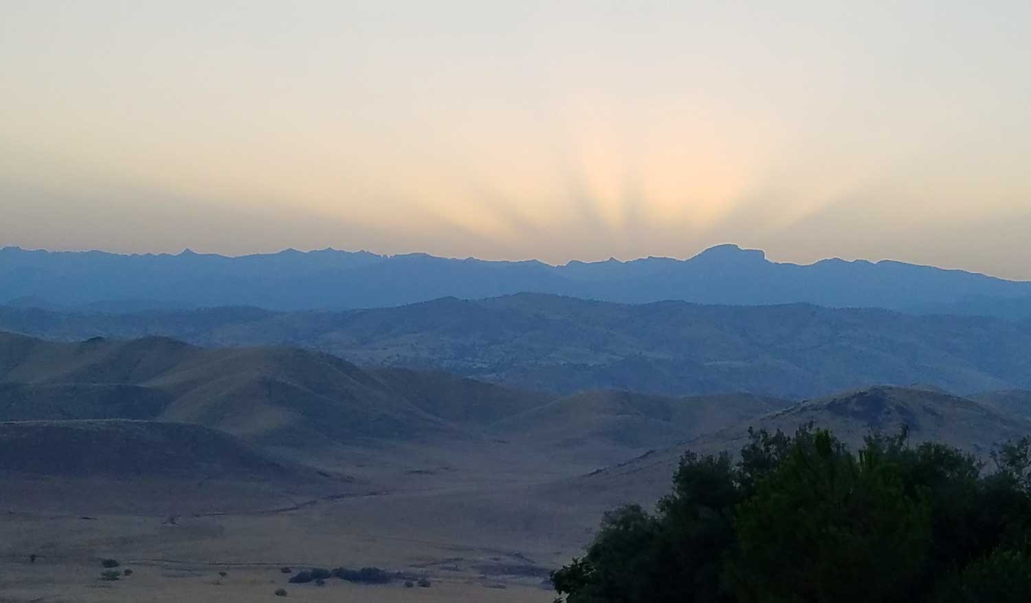
On down we went; the scenery of the Rae Lakes is simply astounding. The trouble was finding a campsite once we got there. Almost every flat piece of ground suitable for pitching a tent was occupied. The place we found was poorly protected and mostly on hard rock. Sam was determined to find a better spot, and cranky and bonked from the long day, suffered a meltdown. He took off, probably intending to reach the car that night. Only a lot of yelling over the radio enticed him back for a hot meal and help setting up his tent. The sunset that evening lit up the mountains over the beautiful lakes, and although I was beat to death at this point, I at least had the presence of mind to capture a panoramic photo of the iconic scenery while the light persisted.

At about midnight, we awoke to the sound of rain on our tent. Sam had been too grumpy to put up his rain fly that evening, so I scrambled out and put it up over his tent to keep him dry. He would have continued to sleep, rain soaking everything, if I hadn’t.
Thursday, August 4
We awoke to gray skies, and what looked like a bit of wet snow on the peaks. We filled the shower and washed our hair, and searched for a good place to use Dude Wipes. The large number of hikers camped in the area made this difficult. In my search, almost every possible rock outcrop had a pile of poop hidden behind it. Even with the limitations on trail permits, this area is overused. But it’s no wonder, I’m not sure I have ever seen a more beautiful place.

This day represented probably our most enjoyable day of hiking. It was downhill, but only moderately. Our only difficulties were the stream crossings, but the hiking poles made these possible. I was able to borrow poles from Sam to get across the log bridge at Rae Lakes, something I would not have negotiated successfully otherwise. Even the rain shower that hit about lunchtime wasn’t an annoyance. We carried pack covers that came in handy, but what stands out in our minds was the bag of dehydrated spaghetti we ate for lunch. We stopped near a cascade on the creek and heated water in the Jet Boil for one of those pre-packaged backpacking meals. Just as we got our lunch ready, the skies opened up and it rained hard for 15 minutes. We sat in the rain, eating hot spaghetti right out of the bag. It was easily our best meal of the trip.
Our destination that evening was the junction of the Rae Lakes trail that comes through Paradise Valley with the PCT; 7.1 map miles, 8.8 by GPS. We arrived with still a couple of hours of daylight, and set up a campsite that seemed luxurious, more like car camping. We had a fire again, and good place for a full shower.
Friday, August 5
The John Muir/PCT turns north at this point, heading up to the Kings River. We followed Woods Creek to Paradise Valley, going down the section that most Rae Lake hikers climb up. In hindsight, I’m glad we did it the other way. While the ascent up the Paradise Valley trail is less steep, much of it is in full sun; the temperatures would have seemed much hotter. A suspension bridge crosses Woods Creek where the PCT junction is; a sign warns that only one person at a time should be on the bridge. It’s pretty stable with one person, but I can imagine that two people would get it swaying and twisting pretty badly.

At this point of the hike, my math skills were severely called into question. Our permit was for a Sunday entrance and a Sunday exit. One week, right? Oops, that’s eight days on the trail, not seven. We planned for seven days of food, and it was becoming apparent that we’d be stretching our resources to stay another night on the trail. After camping in the incredible high Sierra scenery for the last three nights, Paradise Valley wasn’t exactly paradise in our minds, although to insects, it certainly is. But our overwhelming desire to be done was the real deciding factor in our decision to press on towards the cars and Captain Richard’s house. The campsite at Middle Paradise Valley had a toilet advertised on the map, which raised our hopes for a more comfortable Dude Wipe, but our hopes were dashed when we discovered that this is an open-air, no walls facility, and a lot of campers must have experienced great difficulty sitting down, instead choosing to cover the seat and surrounding area with a poo storm. I snuck off into the rocks only to find this area is overused, as well.
Saturday, August 6
The end is near, 7.1 miles to go. The view down Paradise Valley and above Mist Falls, between swats at flies and mosquitoes, is spectacular. We stopped for a snack at Mist Falls, took a family photo, our only one of the trip. Across the river from the top of the falls, we spotted the only bear we saw on the entire hike. It was a fitting end to our wilderness adventure. Below the falls, hordes of spandex-clad day hikers smelling of sweet perfume and hair care products sauntered along, observing our smelly grubbiness with disdain, as they experienced a national park for a few hours before piling back into their SUVs, tailgating and honking at anyone who dares driving the speed limit, only to stop and think nothing of stopping in the middle of traffic if a deer or a squirrel is seen near the highway.

The boys went ahead on down the trail, eager to be home. We were eager too, just not able to keep pace. We agreed to stop at the trail junction and bridge at Bubb’s Creek for lunch, the same spot where we first ate on the trail a week earlier. When we arrived, they were nowhere to be found. A quick radio check found that they were probably a half-mile ahead, having gone past the junction without seeing it. They responded that they would rather keep going than stop for lunch, so we all pressed on.
Back on the flats, the sand didn’t seem so deep. Maybe it was because our packs were lighter and our spirits higher, but this time the “Bataan Death March” didn’t seem so bad; it went pretty quickly. A couple with packs on passed us, keeping a much higher pace than us. They were both younger and obviously in better shape than us. They were ahead of us a few yards when the young man tripped and fell face-first onto the trail. Falling with a full backpack is not a trivial spill; the weight of the pack drilled him into the ground. I scrambled to help him up. It was difficult to tell from the look on his dusty face whether he was hurt or just really embarrassed.
We reached the ranger station, and checked out. The ranger smiled and said we really didn’t need to. Apparently, they only get concerned if your family reports you missing for several days; later we heard of at least two such incidents in the remaining hiking season in the same area. Both resulted in fatalities. You’re on your own out there.
The boys were waiting in the cars, playing video games. We drove down to the restaurant at Cedar Grove and ordered hamburgers. By this time, Sam was so dehydrated and hypoglycemic that when he drank a big bottle of water, it came right back up. A few people looked at him in horror. We didn’t care. We sat down outside and ate some very delicious, greasy hamburgers, chips and I washed it down with a
General Sherman IPA. Jeff went to the Dude Room. And although we showed up a day early at Captain Richard’s house, he took it in stride and again provided us with comfortable beds and a welcoming meal.
We were done! Here's the rest of the
photos.